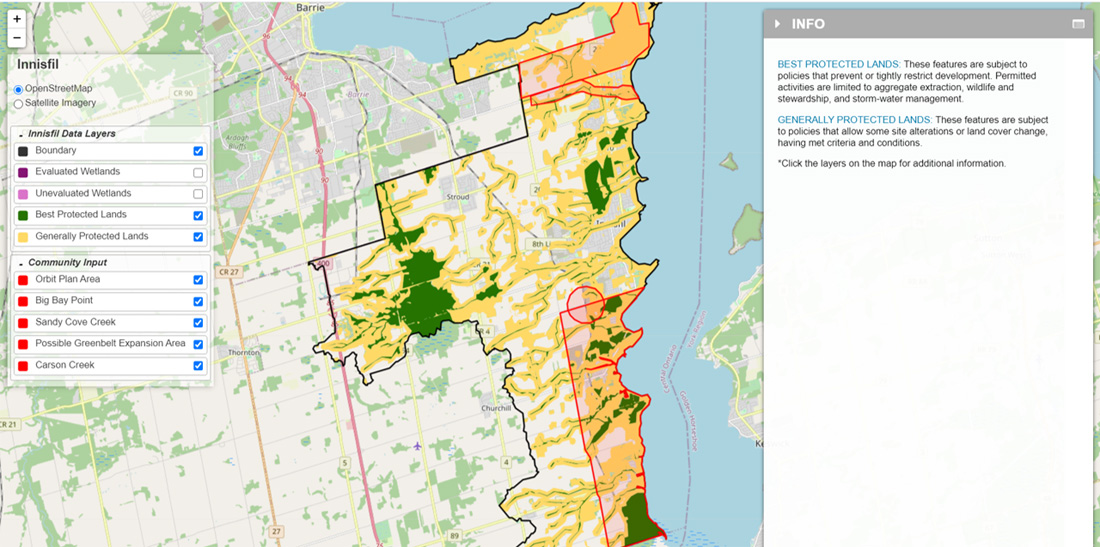
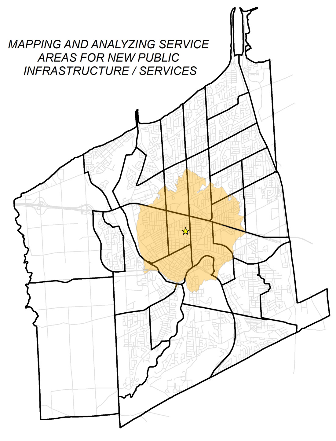
1. Community Mapping
We have expertise to conduct spatial analysis and detailed mapping of local resources, community assets, and socioeconomic / demographic patterns that will increase the spatial intelligence and local awareness in your decision-making. We can share maps and reports in a static report or through online, interactive mapping platforms for broader reach. Our maps and reports can also serve as a basis for data-driven public and stakeholder engagement.
2. Collaborative Mapping
Our community engagement and participatory mapping processes can be designed for wide public outreach and issues management or targeted focus groups and collaborative planning. We focus conversations on the real places and landscapes that matter to people, and in turn provide a forum for meaningful, actionable, and solutions-oriented dialogue.
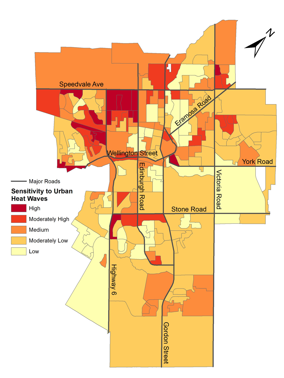
3. Targeted Research and Advisory Services
We are experienced in a wide range of research methods including jurisdictional scans, regulatory analysis, regulatory impact analysis, in-depth expert interviews, public and targeted surveys, and comparative analysis. This research can improve the interpretation and application of our mapping work and, often, we capture the results of this research in stand-alone or complementary briefing notes to support key decisions.
HOW THESE SERVICES HAVE BEEN APPLIED